About USATacCharts Aeronautical Maps
USATacCharts provides offline moving FAA's Terminal Aeronautical Chart (TAC) charts. It includes all 50 states including Hawaii and Alaska. USATacCharts comes with New York TAC map pre-installed. You can download more...
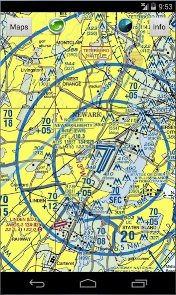
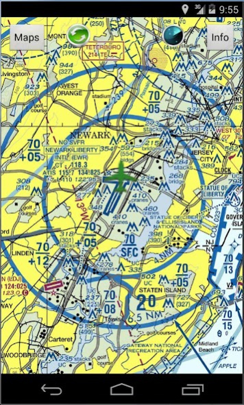
USATacCharts provides offline moving FAA's Terminal Aeronautical Chart (TAC) charts. It includes all 50 states including Hawaii and Alaska. USATacCharts comes with New York TAC map pre-installed. You can download more charts as you please free of charge. There over 14 charts that cover entire United States. You get unlimited charts database update with this app. All charts work as self contained in offline mode where you do not need any network connections (Wifi or 4G). Your current location is shown on a moving map with green airplane icon centered around it. Green update icon will toggle GPS ON and OFF. When GPS is ON, map is automatically centered around current location. To pan maps, turn GPS update OFF and browse map with a swipe. Swipe screen and hit zoom button to zoom in and out. The TAC maps provided is 1:250,000 scale with Class B Airspace shown. TAC charts provide more detail than what found on the Sectional Charts because of the larger scale and great tool for route planners.
*Real-time GPS tracks and navigation
*Terrain maps for the entire USA
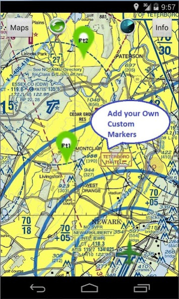
*Add custom markers and way-points for route planning
*Location icon can be centered or track from your placement on screen.
*Made by and for pilots
*Easy to use and learn
*Quick and responsive
*All 14 Terminal Aeronautical Charts (TACs) maps provided free with no in-app purchases
*Runs on most Android devices
*No ads or invasive permission
http://airplanegroundschools.com/android/usataccharts-aviation-maps.php
Previous Versions
Here you can find the changelog of USATacCharts Aeronautical Maps since it was posted on our website on 2016-10-18 06:13:56.
The latest version is 1.0 and it was updated on 2024-04-22 17:39:55. See below the changes in each version.
USATacCharts Aeronautical Maps version 1.0
Updated At: 2015-10-23
Disclaimer
Official Google Play Link
We do not host USATacCharts Aeronautical Maps on our servers. We did not scan it for viruses, adware, spyware or other type of malware. This app is hosted by Google and passed their terms and conditions to be listed there. We recommend caution when installing it.
The Google Play link for USATacCharts Aeronautical Maps is provided to you by apps112.com without any warranties, representations or guarantees of any kind, so access it at your own risk.
If you have questions regarding this particular app contact the publisher directly. For questions about the functionalities of apps112.com contact us.